

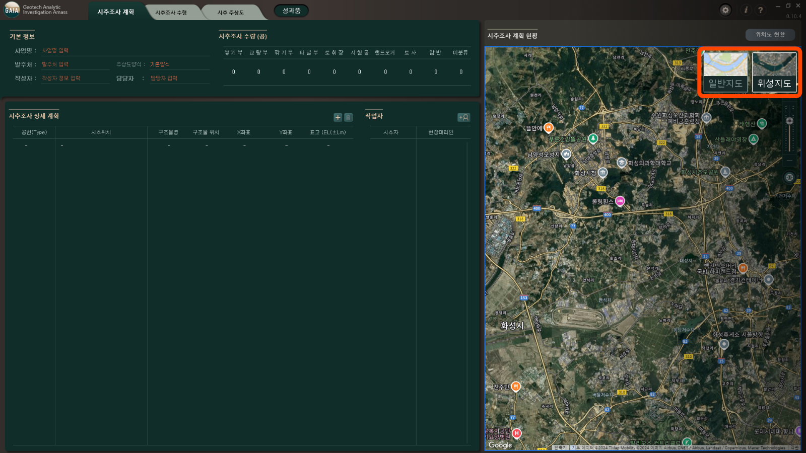
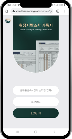
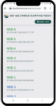
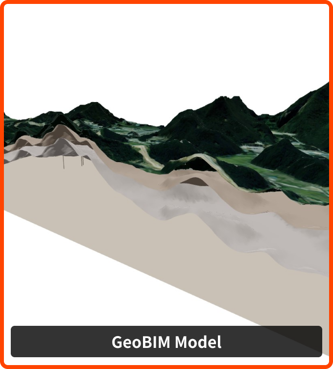
Utilize Web Maps
- a general / satellite map
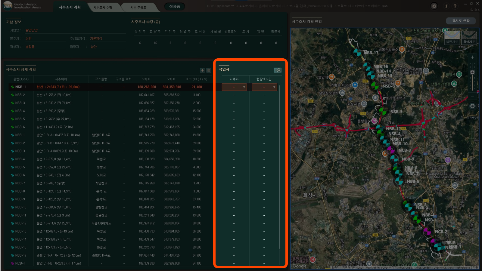
- Insert Linear Information
- Confirm drilling plan

| No. | Category | Title | Date | Status |
|---|---|---|---|---|
| There are no posts. | ||||
| Name |
|
|---|---|
| Mobile |
|
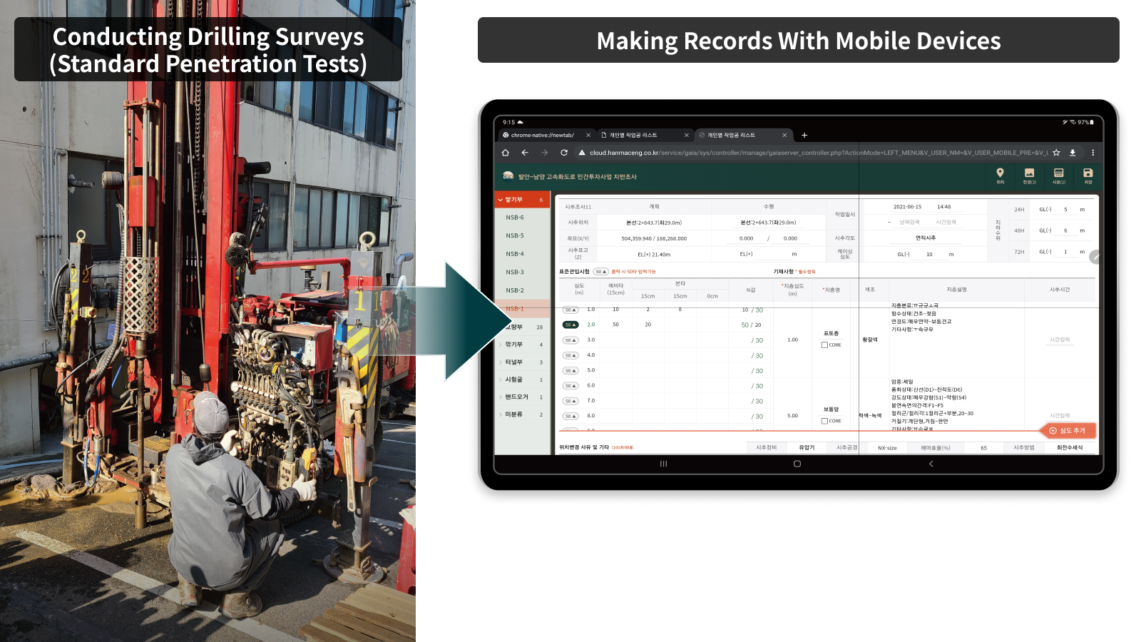
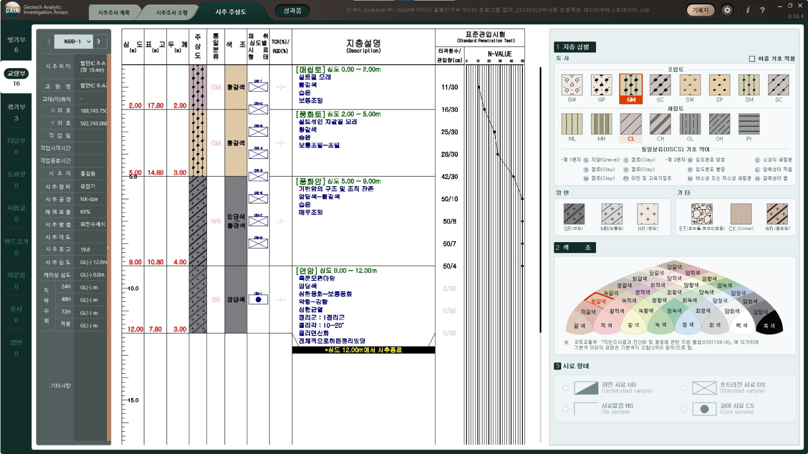
Provides a variety of functions to improve analog drilling research &
to convert to digital processes to improve work efficiency

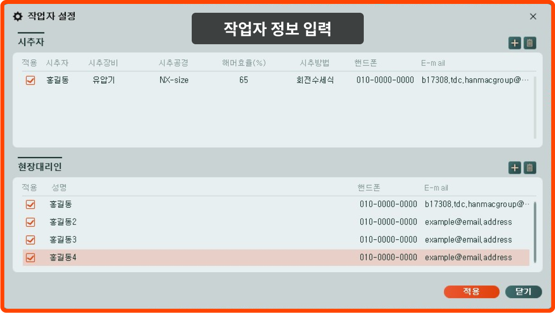
 mobile & email
  designation of
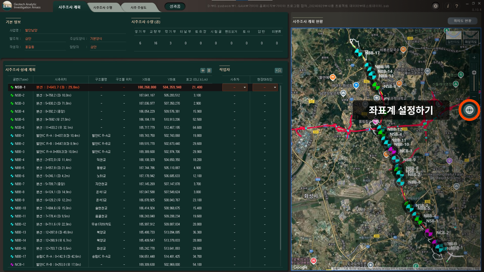

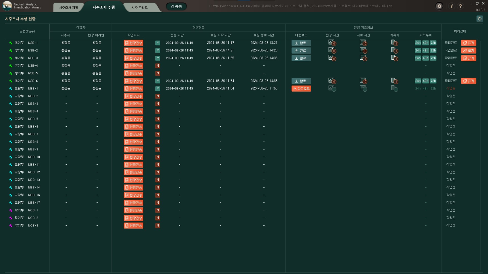

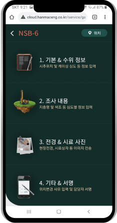

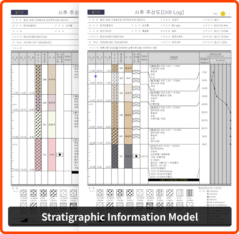
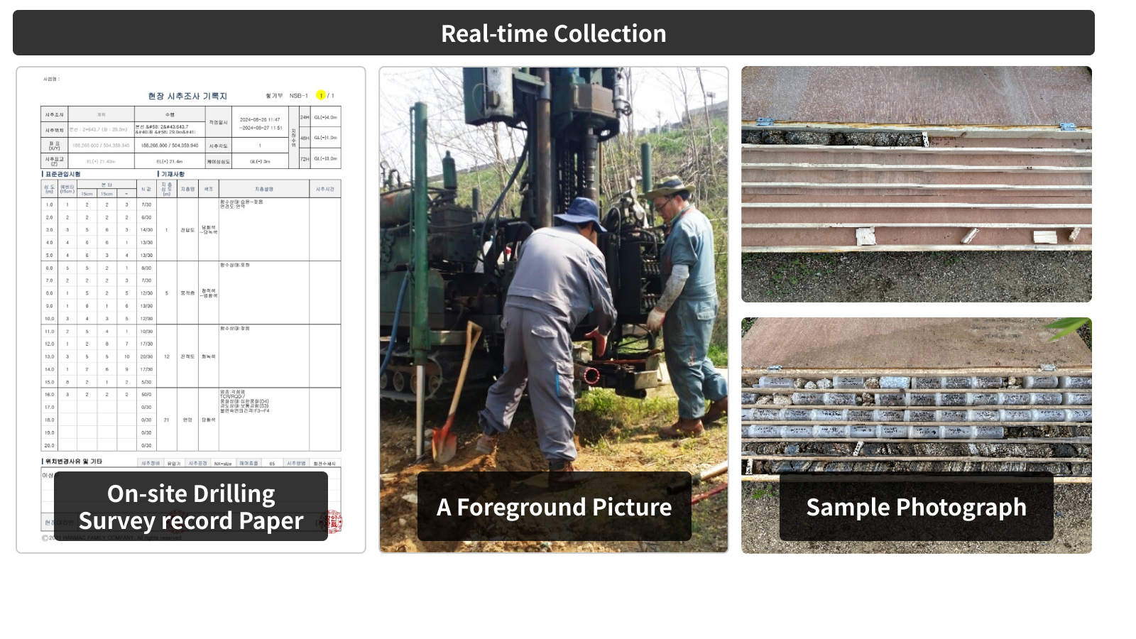
 On-site Drilling
  Sample photograph
 a foreground picture
 groundwater level
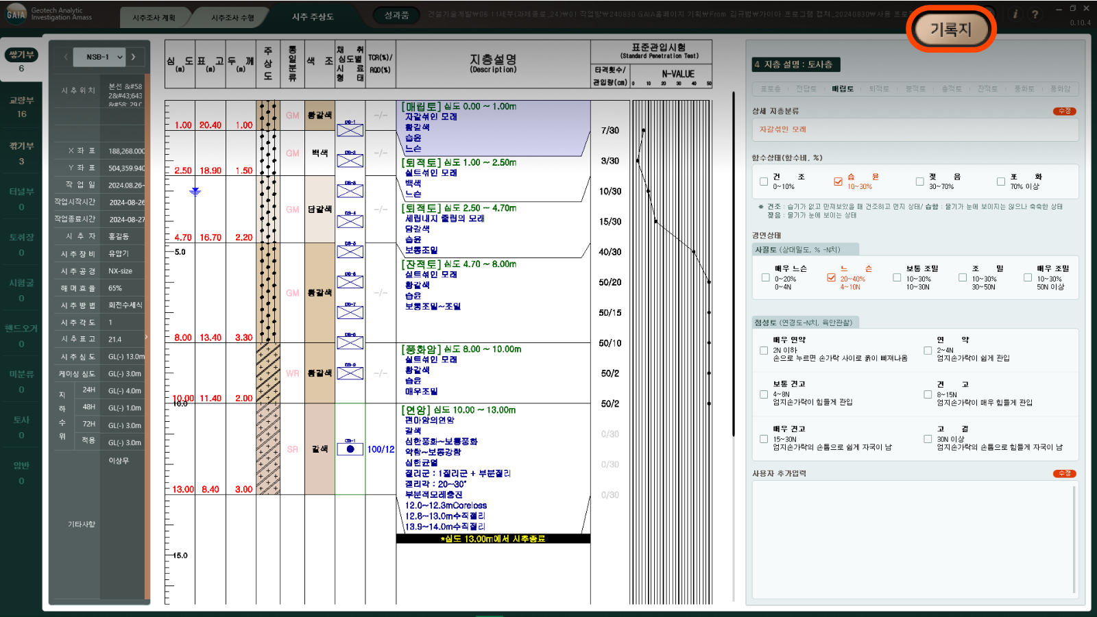


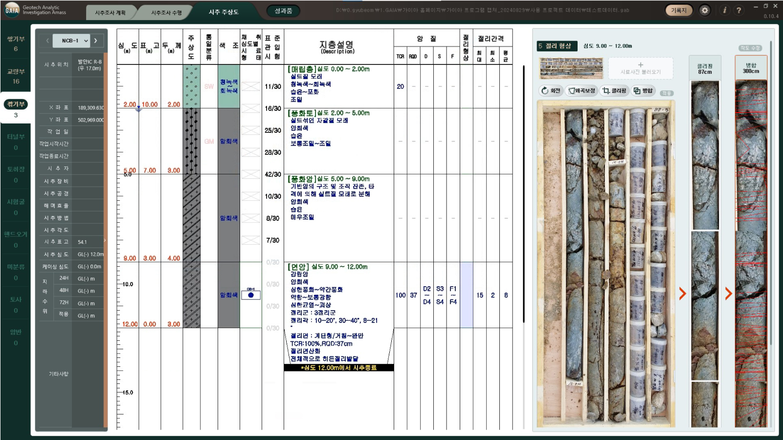
 Rotation
 Distortion correction
 Clipping
 Merging